For those of you who have been following our exploits, the news of the Emerald necklace trail have been long in coming. As a group, we set out to map a circular trail around the entire city that would specifically travel through various parks that we feel could become self sustainable by virtue of their size and location. To enhance the Green or Emerald feel of the proposed trail or route we have created is 100 kilometers long (62.20 miles) of which 40 miles or better is not on a road at all. Yup that’s right! No street traffic, mountain bike trails, no less than 7 virgin forests, designated bike paths and or an occasional unused side walk. The rest is on secondary streets that in many cases pass through beautiful neighborhoods we have discovered over the past 6 years of exploring.
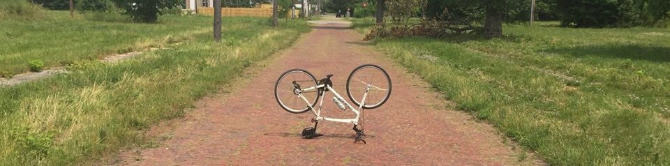
Today we were graced by the presences of our old High School buddy John a.k.a. ‘Drew’ Wyras. Mr. Lt. Coronial, soon to be retired ex Ranger and Hero of the Iraq war! The third Musketeer to Me and Big Mike, who traveled all the way in from the Quad City Iowa to join us this weekend. With Dartanian a.k.a. ‘Dan the Man’ making out the 4th corner to the group, we all met up at Palmer to begin the ride at 7:30am.
Palmer Park is the Pendant or central jewel on our proposed necklace. With over 6.2 miles of ancient Indian trails that swoop up and down over virgin water shed topography, set in and amongst an ancient Oak-Beech climax forest, there simply is no other Park/Place like it in all of Detroit! Virgin forest #1! We chose the midway point and went counter clockwise in lieu of time constraints as we were expected back at Palmer by 11:00am so that we could make ready for the summer picnic and hayrides that were soon to follow. Knowing we would only get to see about a 3rd of the route we thought this way was the best all things considered.
Without much fan fare we were off and all that were present soon were surprised by the beauty, the majesty, and the hills. Exiting the forest behind the 12th precinct we were all sweating as we turned left and followed the asphalt boundary trail over to Sherwood Forest Subdivision. From there down Outer Drive and onto our first Park situated between Pembroke and St. Martins and Wyoming and Pinehurst. From there we traveled on through portions of Comstock field and then up and centered on a pedestrian bridge over the M-39/Southfield freeway construction zone. We stopped to take in a breath and enjoy the peace and quiet of the elevated view. The truck drivers looked up and smiled, perhaps enjoying a site they had yet to see?
From there it was a quick swizzle and a dash to Pembroke Sunderland Park and Virgin forest # 2. We first opened these trails out there two years ago and have not been back this year. Noting the trial work that will soon be done we exited out of the forest and turned left around an ancient Burr Oak that has been confirmed as being in excess of 350 years old! No Kidding! From there west on Trojan Street turning slight left and into Tuttel Park and Virgin forest #3. I love this place, a whole city block, Virgin stand 225-300 years on the biggest one.
From there we made our way south and over onto Margareta and headed west until it dead-ended into yet another hill and forest. Darting across Lasher we found our way onto the Rouge River watershed and slid by the magnificent homes that sit behind the William Rogell Golf Course. Crossing over Grand River and Then 6 mile onto ‘Beaverland’ we enjoyed, what we all felt must have been ‘Cottage Architecture’ as we thought that back in the late 1800’s to early 1920’s the area we were traveling through was a cottage destination spot, set in echoing fashion along the bluff facing river’s edge. From there we snaked around, crossed over the river and then took the sidewalk along 6 mile for a block and made a hard left down River Dale Street, sliding down the slope to a hairpin turn at the foot of Dehner & Riverside Park. This is a Park that has been abandoned form the 1950’s and is ripe with hidden trails waiting to be cleared and discovered.
From here it is all trails, slicing down the gravel access road that leads behind Dale Street we made mention and comment to the illegal dumping that was being done by the Major Cement Company, whose employees were busy setting up high powered cameras to watch the trail? Words were exchanged, Big Mike thought I was a little harsh but, limestone and cement leaching with surface run off changes PH and poisons the RIVER! From there across Fenkell and in through Eliza Howell Park and on buy the largest tree in the city, (Burr Oak, 10’ across at the base as confirmed at 475-550 years old by Paul from Greening of Detroit), we crossed back over the river on the pedestrian bridge while I deliberately slowed down so as to enjoy yet another ancient virgin stand #4 set in and amongst the river’s edge. The fellows were wondering at first why the pace was abated? Did not take them long to understand why!
Out of the forest and making our way across on Kendall we turned right onto Lasher and made our way across 96 and down on Dolson Street. When we mapped out the route we were always working clockwise from the Detroit River on up and around. Since we all decided to work in reverse the next trail was almost impossible to find. Dumped out on the Rail Road tracks we wash boarded it down the center all the way to Outer Drive. People who were crossing over the tracks in their cars stopped on more than 1 occasion to take in a sight never seen! We all made it down and as we dismounted to gain some breath we found the trail north of the tracks which is only visible form the entry point adjacent to Outer Drive.
From there on it was into Rouge Park and the designated asphalt Biking trail, with a quick-slight right we entered into the old Meyers Tree Farm and took the center trail all of the way through. Dumping out and across the road we found ourselves back on the asphalt bike trail for less than 100 yards. The old Comfort station to the west up on the hill secretly guards yet another set of trails through yet another Virgin Oak-Beech Climax forest. Up and down and around throughout the virgin water shed topography what fun. On the way out there is a quick/fun deep dip that happens just before you make your way back near the old comfort station, shoots of waaahoo! could be heard from all who were present. From there it was back across and onto the trail crossing over at Warren. From there down a steep slope adjacent to Outer Drive we found the first of the parks in Dearborn that we have used to connect the western part of our Emerald loop. Taking a break underneath the Picnic Shelter we considered the time and contemplated our next step.
Realizing we were getting on in the day we all agreed to break off the trail turning left at Ann Arbor Trail, switch back along Paul to Oakman Blvd, left again all the way to Hamilton and onto the chore of preparing the hayride so that we could continue celebrating the rest of the day!
Bike Detroit! J. Meyers bike explorer.

The only comment I can add is I am sorry to have missed such an adventure. Thanks to your blog we can all experience it vicariously though. Thanks Jim!