8/4/2011 Emerald Necklace Trail Part Three!

The fervor of excitement continued on this week as we both were desperate to see and experience the final section of our proposed loop. This Thursday night’s theme was ‘City Parks’ and since the Emerald Necklace is about Parks why not ask the group if they were up for it? To the experienced group of riders assembled, we explained the intent an asked those present if they were up for a potential 40+ mile ride to head up and out around the Eastern Section of the Emerald Necklace. Given what all present had seen/heard about it the trail it did not take long for all to agree and for us to get up and go!

Doing it section by section demands that you travel out to the loop to pick it up so as to continue. Straight North once again onto 2nd Ave. we turned, having fun, playing tag all the way up to Palmer Park. Since Palmer is the Emerald Pendant to our proposed Necklace/plan/trial, I decided to take the group through a section of trail that they had never been on before. Hopping the Kerb at dead end of 2nd, we jumped into Park #1 of tonight’s tour, onto the asphalt trail and strode straight up middle through and entered in on a slight right just past the old handball courts. Snaking around corners opened only weeks earlier, we snaked around right and left making our way out to Woodward as Nevada St. picks up where we left off. As we came to the exit point I stopped the group and invited them to pose for scale, next to one of the newly accessible Palmer Park Virgin Oaks? Smilingly they all agreed, once camera pictures were done, I swung around 180 degrees, walked 4 paces, and looked up to marvel yet another grand old fellow!

The problem with the East side loop is where to stop for refreshment breaks? We talked about it once out of the Forest across Woodward heading East on Nevada. Nobody had any suggestions on where to stop. A problem soon to be addressed! Crossing over I-75 we made a quick left up Hawthorn and after a 1/2 block slide slight right into Park #2 on Today’s tour. Huge group of Basketball thugs playing, with the boy who had something to prove shouting, “Get the F— out of our Park”! Obviously educated and enlighten words, as we were exiting North we noted a fine group of 4-5 horse shoe pits clean and ready for action. Right on Grixdale, 8 blocks East we made a slight right and cut across at a diagonal park #3. Nice open field cut down nice attached to an old school. South on Fleming we turned right onto Minnesota and we were soon met and warmly greeted by various families and children cheering for the bike riders! East again to just past Charest, slight right and on into Park #4 we did turn. Many abandon fences were taken over by a native Concord grape variety. It looked better than a vineyard and the crop that soon would be ready to Harvest in two weeks time had us all thinking about a combined return trip with harvesting tools and bushels a plenty! If you ever wondered if grapes could be grown in our region/select micro climate, the answer is YES! Out of the Park after a breather, the conversation continued on where to stop as we turned right onto Moran.

This slideshow requires JavaScript.

Crossing over left at Luce Street we entered into the Jayne Playfield/Park #5. Huge, well kept ball fields of all sorts, abound. Wow who wouldn’t want to come to this park and play sports? Traveling through the park via the middle asphalt trail, we soon found ourselves crossing over Fehelon St. Entering into Park #6. This Park is all at once beautiful and open, natural in feel, disarming by comparison, to our 2nd park of the night’s tour. Snaking on through, left on Charles for a block then a quick left on Ellery we made our way SE into Hamtramck on bye park #7 ‘Recreation Field’. Continuing on down we made a left onto Conant St, just past the bend, further south we traveled, left onto Vincent, the route back North to Park #8 was blocked. Stopping to check the Map once again the group started to ask, “When are we going to stop for a break?” Needless to say around these parts there is not much, especially any buildings that are open to the public. I thought to myself I better push it up a bit and get on to an area that would have a rest stop open. Right onto old Mt. Elliot left onto Hientz we entered into a vast wasteland of leveled residential city blocks that had been captured and were to be re-positioned into a vast commercial zone, Ooops the great down turn sunk that idea in a hurry. Down Sherwood, left onto Strong we finally made our way over to St Cyril street turning left to enjoy the only ‘Bow’ shaped road in the entire city, who’s that Plucking Yew? Crossing over Vandyke we headed east on Grinnell on our way to Park #9.

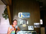
Skirting around the trial at Conner Park we crossed over I-94 on Conner Street soon turning left onto Shoemaker/Chandler Park Drive on into Park #10. Hopping the kerb to off-road east of the great water slide, the turf was thick, wet and deep. It was like swamp mermaids, with strong fingers and hands reaching up through the thick wet strands in a vain attempt to grab hold of our feet. We did not stop but what breath we did have left, from the now 2 hour + ride, was getting used up in a hurry. Slowly we poured out and over the defining kerb making a slight right we headed down on Gray Street. It was after this turn that Jen said she had had enough, and would really enjoy a bathroom break! With Dan in agreement we traveled fast and hard down to Kercheval turning left so as to go into GPP where we knew a place or two would be waiting. On our way over the Texas Bar caught our eye and the next thing you knew we were being Buzzed in and greeted by a Crazy lady that liked to dance. Cool this is my kind of place.
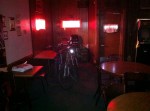
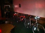
I won’t boar you with the tales of Miller High Life and Waters. All I can say that this place is yet another distinct venue where judgment was left outside with your horse, after all it is Texas. Back up on the saddles again we headed back to Gray then left on down, later joining Dickerson for our over-the-grass-far-east-entry into the back side of Algonquin Park #11. Blasting in and onto the waterway trail we made our way across the bridge and on up the hill to stretch and take in the sites of the water way sliding by, turning to enjoying the sun set stretched sky in the opposite direction. From there it was out to Freud, left over to Harding, right over Jefferson, left at Kercheval, left on Pennsylvania, right on St. Paul, left on Crane then straight across Jefferson into Erma Henderson Park #12. Quick sidewalk trial tour then north to the east bound Jefferson sidewalk trail, in opposite direction west, we soon found ourselves turning left down into the Last Original Ribbon Farm and subsequent most historic site left in the city. Owen Park #13.

Okay darkness was falling all around, back across Jefferson for a brief tour of Shipherd Ct. sprinting east on Lafayette, left onto Mt. Elliot and into Park #14 aka the east end of the River Walk. We all shouted out one more stop please so yet again we made our way into Andrew’s place where ole big burly buddy was waiting glad to see us. Quick hello and quick good bye our next stop would be Jacoby’s for some good late night food as EVERYONE was hungry. It was 6:00 when we started tonight’s ride and it was 12:00 when we finally made it back to MCB. Some say 36 I say 42+. Needless to say we all felt it the next day as we talked about how to change the Eastern leg of the Necklace to have more stop location and maybe even consider including Balduck Park, knowing full well that the Emerald Necklace would have to expand beyond the 100 K presently proposed.

Bike Detroit! Bike the Emerald Necklace!

J. Meyers bike explorer.

7/30/2011 Emerald Necklace Trail Part Two!

All week long Dan could not stop talking about getting back out on the Emerald Trail. He wanted to see it all! We talked about it with our wives on the Thursday night ride and got an OK to return to the trail Saturday morning. Arriving at MCB @ 8:15, it did not take Dan long to bounce on down from his elevated office, out onto the parking lot with his good old bike well in hand. Today we were going to start the Emerald necklace Trail from the Park we used as our Starting/Finishing point while mapping. Riverside Park at the foot of Jefferson and Grand Blvd. is where we started to map out the Emerald Necklace last February. As we snaked our way down to the starting point, my good friend Dan did not call out ‘Right Turn’ as he cut across my path, I snatched the brakes but was unable to prevent my first fall in over 6 years! Darn man, I mean we all got to call out our turns, Right? Whatever! No trail rash, no blood, and no wounds, let’s go!

Blasting by Composite Forging always reminds me of the dirty sobering echo of our cites past glory and fame. But given the toll on the Environment and moreover the Great Lakes, I thought to myself that maybe the real blessing of this hardship is the healing of the Great Lakes and maybe Mother Earth Herself? Anyways, we skipped around the fence near the ambassador bridge and soon found ourselves floating on by Riverside Park on Jefferson, then Entering into Ft. Wayne. A hard left and yet another, quick right at the dead end, brought us over and down into the Moat that used to surround the Fort way back when. Kind of cool as you can side- climb and swoop up and down as much as you want. Heading out and around the Fort we dived towards the water and got off for a minute to stretch and take in the murmuring sounds of the Detroit River. The local mail boat made two separate visits to the Large Freighters passing us by, sounding soft toots of the horn as in a way to say goodbye. Back around the westerly boarder trail that encircles the complex, on through the old officer housing, (found falling back to the ground rotting in decay), we headed back out onto Jefferson, left to Green, right to Lafayette, left to Springwells, right to Homer, were we turned left into the Iliad of our own invention. From there it was straight to Woodmere Cemetery Street right, making our way to Vernor, crossing on the green light, slight left entering up and into the ADA sidewalk enhancement ramp, darting up the hill under yet another Virgin Oak Savanna Forest Cluster.

We dismounted right in the middle of the sacred stand, opened up our hearts, attempted to stand, stretched wide to the sky, open to understand. The place has its own vibration, its own hum if you will. On a picnic table nearby a fellow was still hoping to gain, body language restless and in pain, please just a little more sleep, tirelessly he wrestled with the 4’x8′ sheet of plywood he had on top of himself to protect him from? We guessed the weather. We talked about the Secret Mysteries as a Muslim fellow moved, affixed himself kneeling up the hill towards our direction, making good use of his hopeful prayers in what would be loosely termed a Pagan Temple. Up on the saddles, flying down the hill, darting right on a never used sidewalk we flew down and around Patton Park, curving right at the tip we cross-walked over Dix onto Roulo entering into Dearborn on our way to Lapeer Park.

Left on the asphalt pedestrian trail, on up the huge, (Jim gets off his bike and walks up the last 23′ of the Burm) hill, we circled gently out to Eagle left, on pass ‘Johnny’s Place’ making another quick left on Salina we headed south, pivoted west around the dead end, spilled out onto Dix and then slid left, up on the sidewalk, under the rail road track bridge, on our way over to Mellow Street. From Mellow Street we rode on Past Schaeffer Hwy., and soon made our way north along side of the Rouge River. This is where I knew the fun would really start to begin!

This slideshow requires JavaScript.

In an L.A. Storm Drain like fashion, Mr. Ford and the Dearborn City Council saw fit to make the Rouge run through a concrete basin, from roughly his house at Fairlane all the way down to his newly constructed Rouge Plant. Surrounded with Army Core of Engineer flood plains and dykes, I am sure it wasn’t the best thing for the environment. With that being said and with all the time that nature had to heal, it sure seems like a good idea to me. Especially when the cement embankments offer a hard packed trail right along the river for any and all to enjoy? As Jon would say “Are you kidding me”? Man this was great fun, miles and miles of un-interrupted flow, no cars except for a few fishermen, this place is unreal and open to all of us pedestrian bike-coholics. Under Greenfield, then under I-94 too, down under Rotunda Drive, miles and miles of side slippery slide river trail. We pushed hard all the way up to the newly reopened watershed stream-bed that exit’s ‘Naturally’ through our concrete trail, out from Henry Ford Village, effectively stopping our proposed trail directly in its tracks. Nice improvement! Would have been cool to have a pedestrian bridge? What made matters worse they had built a 6′ high fence and posted signs of do not trespass! Well we hopped on over and in, but instead of continuing our way North, along the river easement, which is open to all, including pre determined setbacks as per Michigan State Law, we instead turned left and made a bee-line out, exiting the property proper form. We will have to figure something out or get them on Board for what we are hoping to do. Okay I will kind of admit it was fun going through and around the village of Henry Ford. The only downside is cars and the drivers therein. This is the Goal of going Emerald, it is the path least traveled, a green world of pedestrians. A world without cars and their influence unto and into the pedestrian stream of things, at least to us, is like the kingdom returning unto the earthly plain.

Anyways, we finally came round and darted east along Michigan until we had clear-to-cross, quickly we found ourselves on a great pedestrian trail, slight right finally we were in. Along the North side of Michigan Ave. between Brady and great big bad Evergreen, you will find an 8′ asphalt path that runs and plays in harmony dance with the river and the native watershed-land. Bridges cross over the river two separate times, up and down watershed half pipes, the path leads its way around Fairlane, UMD campus, Henry Ford Community College, under Ford Road and conveniently dumps you out into Hines Drive/Park. If you only hit this trail please do so and do so often as fast as you dare or like!

New Park, new vibe, new feel, okay, waking up, we avoided traffic and hit the brakes and then the asphalt trail of Hines Park which could only be described as something quite different from just a few seconds ago. Flowing left/west, one premature/explorative right turn led us down an arm of the natural watershed grade, we followed a stream down and down, snaking-making its way to the Rouge River, at the dead- end- forest we spun back around and slowly climbed our way back out to the road side trail. Looking at the map so that I would get it clear this time, it seem shortly to me we would find, our path and the last dreaded incline. 250 yards west/later we found the river shed lawn park grade opening out. Made our way slight right, in through wet thick grass and climbed our way out onto Ann Arbor Trail. 100 yards from the exact same place we conclude Part 1 a week earlier. From there and without hesitation we jammed it east out Paul and made our way back to MCB with only a slight water brake, on back to our homes, our wives and kids making 12:30 seem right to everyone.

Bike Detroit! Bike the Emerald Necklace!

J. Meyers bike explorer.

7/28/2011 Thursday Night Ride

Tonight we were finally joined by our new friend Steve, owner/sponsor of the Motor City Brew Tours. He had made a promise way back in May to get out on one of our rides and finally he was there in full living Color. The theme of tonight’s ride was a ‘Boulevard Blast’. With only 6 of us present, I put it up to the group to decide where we would be riding on tonight’s ride. I planted a seed in which I shared with the group that on one of my rides over to the office one Saturday morning I rolled by a sign on a building that stated it was the oldest bar in Detroit? It did not take the group long to decide that that would be our destination spot tonight.

It was in the 90’s and most of us started sweating in the parking lot before we even mounted up on our bikes. Our destination was the Two Way Inn, (www.twowayinn.com), situated on the Corner of Nevada and Mt. Elliot. The sign out front stated that they had been open since 1876 and with 135 years behind them we all thought it would be a worthwhile journey. Starting out right we headed straight up Second through Wayne State Campus before we switched back over and turned right on Palmer, over to Beaubien and then left through the Old French Quarter section of the city. Steve made mentioned how in some cases it looked just like the French Quarter down in New Orleans as many of the buildings were built back in the 1800’s. Our first stop tonight was going to be the Rathskeller as Steve made mention that, “a good German Lager would suit him just fine on a hot day like this.” Upon our arrival, we were surprised that the place was closed even though the sign that was posted stated that they would be open? Hmmmmm, I hope our city didn’t lose another great old Historic Place. As we mulled around the sidewalk/corner the question was put out, should we chug on over to the Two Way or hit something close to re-hydrate? Unanimously the vote rang loud and in a step of a peddle, we were off to Ye Old Stone House.

If you have not been, we recommend you pay the Stone House a visit. This old blind pig still has a tunnel entry that run’s underneath Woodward over to a home in Palmer Woods Sub. When Clint Eastwood was in town filming the Grand Torino he stopped by to inquire. They opened her up and guesstimated that someplace near Woodward the tunnel collapsed forever blocking the way. The Stone House is noted as being a part time Biker Hang Out but as long as you are on two wheels all are accepted and welcomed in. The owner was happy to see us and with PBR’s and Pitchers of water. We headed on out to the front porch to relax and take in the view. Half of the group went upstairs to the Playrooms/Bedrooms and headed out on the second story front porch to take in an elevated view. Steve was doing most of the talking and oh by the way the boy has lots to say! The owner brought us out a free Stone House Burger that Dan desperately enjoyed as this fine fellow forgets to eat some days when he is making all of that delicious and wonderfully organic beer. We ordered three more and had them shipped up top for Steve, Jen, Val, and Matt. With an hour of relaxation behind us we were finally off and sprinting back south to find Nevada and make our way east.

Matt attached hard and Dan played catch up each time, were mostly I cruised caboose keeping my eye on the group and the surrounding neighborhoods. All of a sudden we found ourselves at our target destination. We knocked, it took a minute and finally we were buzzed in and welcomed warm heartedly! The rumors were true. This is the oldest bar in the city and the two younger generation guys running the place were very happy to see us. A shout went out for more PBR’s and then the good conversation really began. What History, Brothel, General Store, Blind Pig, this place had seen it all and the historic photos that adorned the wall showed a picture of each incarnation. What Dan was struck by most is the old black and white picture showing a family along Conner Creek way before anyone considered putting it into a pipe and filling up the watershed. Way cool, Dan told me that that is the picture he really wants! The owners made us feel great and welcomed. What a fun time as we plan to take people here again. With fond fair thee well’s being said we turned right onto Mt. Elliot and played sprint/attach all the way down to the river. With a quick right and swizzle along the river front trail, we soon made our way literally right into the Atwater Brewery, were any a bike rider can ride his or her bike right into the brewery and on up to the make shift bar. I cannot think of any other establishment in the country that offers bike riders a path like this?

As it was getting on late in the evening we had just one taste and were back again up on the bikes, riding out of the brewery on past the overheads door as making our way through Brush Park and on back to the MCB. All week long we have been talking amongst ourselves that perhaps this was the best/most fun any of us ever had on one of our Thursday night rides? I cannot remember any more fun than this one, maybe Steve had something to do with it?

Bike Detroit! J. Meyers bike explorer

7/23/2011 Emerald Necklace Trail!

For those of you who have been following our exploits, the news of the Emerald necklace trail have been long in coming. As a group, we set out to map a circular trail around the entire city that would specifically travel through various parks that we feel could become self sustainable by virtue of their size and location. To enhance the Green or Emerald feel of the proposed trail or route we have created is 100 kilometers long (62.20 miles) of which 40 miles or better is not on a road at all. Yup that’s right! No street traffic, mountain bike trails, no less than 7 virgin forests, designated bike paths and or an occasional unused side walk. The rest is on secondary streets that in many cases pass through beautiful neighborhoods we have discovered over the past 6 years of exploring.

Today we were graced by the presences of our old High School buddy John a.k.a. ‘Drew’ Wyras. Mr. Lt. Coronial, soon to be retired ex Ranger and Hero of the Iraq war! The third Musketeer to Me and Big Mike, who traveled all the way in from the Quad City Iowa to join us this weekend. With Dartanian a.k.a. ‘Dan the Man’ making out the 4th corner to the group, we all met up at Palmer to begin the ride at 7:30am.

Palmer Park is the Pendant or central jewel on our proposed necklace. With over 6.2 miles of ancient Indian trails that swoop up and down over virgin water shed topography, set in and amongst an ancient Oak-Beech climax forest, there simply is no other Park/Place like it in all of Detroit! Virgin forest #1! We chose the midway point and went counter clockwise in lieu of time constraints as we were expected back at Palmer by 11:00am so that we could make ready for the summer picnic and hayrides that were soon to follow. Knowing we would only get to see about a 3rd of the route we thought this way was the best all things considered.

Without much fan fare we were off and all that were present soon were surprised by the beauty, the majesty, and the hills. Exiting the forest behind the 12th precinct we were all sweating as we turned left and followed the asphalt boundary trail over to Sherwood Forest Subdivision. From there down Outer Drive and onto our first Park situated between Pembroke and St. Martins and Wyoming and Pinehurst. From there we traveled on through portions of Comstock field and then up and centered on a pedestrian bridge over the M-39/Southfield freeway construction zone. We stopped to take in a breath and enjoy the peace and quiet of the elevated view. The truck drivers looked up and smiled, perhaps enjoying a site they had yet to see?

From there it was a quick swizzle and a dash to Pembroke Sunderland Park and Virgin forest # 2. We first opened these trails out there two years ago and have not been back this year. Noting the trial work that will soon be done we exited out of the forest and turned left around an ancient Burr Oak that has been confirmed as being in excess of 350 years old! No Kidding! From there west on Trojan Street turning slight left and into Tuttel Park and Virgin forest #3. I love this place, a whole city block, Virgin stand 225-300 years on the biggest one.

From there we made our way south and over onto Margareta and headed west until it dead-ended into yet another hill and forest. Darting across Lasher we found our way onto the Rouge River watershed and slid by the magnificent homes that sit behind the William Rogell Golf Course. Crossing over Grand River and Then 6 mile onto ‘Beaverland’ we enjoyed, what we all felt must have been ‘Cottage Architecture’ as we thought that back in the late 1800’s to early 1920’s the area we were traveling through was a cottage destination spot, set in echoing fashion along the bluff facing river’s edge. From there we snaked around, crossed over the river and then took the sidewalk along 6 mile for a block and made a hard left down River Dale Street, sliding down the slope to a hairpin turn at the foot of Dehner & Riverside Park. This is a Park that has been abandoned form the 1950’s and is ripe with hidden trails waiting to be cleared and discovered.

From here it is all trails, slicing down the gravel access road that leads behind Dale Street we made mention and comment to the illegal dumping that was being done by the Major Cement Company, whose employees were busy setting up high powered cameras to watch the trail? Words were exchanged, Big Mike thought I was a little harsh but, limestone and cement leaching with surface run off changes PH and poisons the RIVER! From there across Fenkell and in through Eliza Howell Park and on buy the largest tree in the city, (Burr Oak, 10’ across at the base as confirmed at 475-550 years old by Paul from Greening of Detroit), we crossed back over the river on the pedestrian bridge while I deliberately slowed down so as to enjoy yet another ancient virgin stand #4 set in and amongst the river’s edge. The fellows were wondering at first why the pace was abated? Did not take them long to understand why!

Out of the forest and making our way across on Kendall we turned right onto Lasher and made our way across 96 and down on Dolson Street. When we mapped out the route we were always working clockwise from the Detroit River on up and around. Since we all decided to work in reverse the next trail was almost impossible to find. Dumped out on the Rail Road tracks we wash boarded it down the center all the way to Outer Drive. People who were crossing over the tracks in their cars stopped on more than 1 occasion to take in a sight never seen! We all made it down and as we dismounted to gain some breath we found the trail north of the tracks which is only visible form the entry point adjacent to Outer Drive.

From there on it was into Rouge Park and the designated asphalt Biking trail, with a quick-slight right we entered into the old Meyers Tree Farm and took the center trail all of the way through. Dumping out and across the road we found ourselves back on the asphalt bike trail for less than 100 yards. The old Comfort station to the west up on the hill secretly guards yet another set of trails through yet another Virgin Oak-Beech Climax forest. Up and down and around throughout the virgin water shed topography what fun. On the way out there is a quick/fun deep dip that happens just before you make your way back near the old comfort station, shoots of waaahoo! could be heard from all who were present. From there it was back across and onto the trail crossing over at Warren. From there down a steep slope adjacent to Outer Drive we found the first of the parks in Dearborn that we have used to connect the western part of our Emerald loop. Taking a break underneath the Picnic Shelter we considered the time and contemplated our next step.

Realizing we were getting on in the day we all agreed to break off the trail turning left at Ann Arbor Trail, switch back along Paul to Oakman Blvd, left again all the way to Hamilton and onto the chore of preparing the hayride so that we could continue celebrating the rest of the day!

Bike Detroit! J. Meyers bike explorer.